
Breaking News
Beach at Gillespie Lake officially open

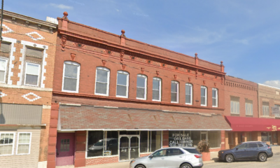
City officials and top contractors involved in reopening the beach at Gillespie Lake announce its official grand opening Wednesday afternoon.
City officials gathered at the completed beach area at the new Gillespie Lake to celebrate its grand opening on Wednesday afternoon after state inspectors approved the beach for swimming earlier in the week.
The beach is located on the new lake complete with over 150 tons of beach sand and is currently scheduled to be open for swimming between 10 a.m. to 7 p.m. although no lifeguard is on duty and swimmers are cautioned to swim at their own risk. Children under 16 must be accompanied by an adult and parking is available in the expanded parking lots near the clubhouse.
Gillespie’s City Council weighed the decision to reopen the beach since March when Lake Superintendent Gary Thornhill asked the council for consideration. Once the city’s insurance carrier gave the approval, the project got underway with the help of city crews, Mike Ranger Excavating and Elite Technology and Graphics who designed the signage.
Lake Chairman and City Alderman Steve Kluthe credited the reopening of the beach to Lake Superintendent Thornhill saying, “A lot of things have changed at the lake since the city hired Thornhill.”
Thornhill said Mike Ranger Excavating dredged the entire area and hauled in seven semi loads of fine beach sand ensuring a comfortable walking surface on the bottom of the lake to the safety line that extends approximately 30 feet from the shore.
“The beach is free to the public,” Thornhill told the media Wednesday afternoon. “But there is an absolutely zero tolerance for alcohol or glass bottles.” Kluthe added by saying smoking is also discouraged and pets are not allowed on the beach area.
Extensive rules and regulations are posted on the beach.


Comments


Another major winter storm is forecasted to blanket the BenGil area in heavy rains, flooding and snowfall starting Wednesday night through Thursday.
The mixture of precipitation and rapidly changing weather likely will produce the potential for sudden icing on roads, with high winds leading to blowing snow and reduced visibility.
“The Illinois Department of Transportation’s snow-and-ice teams will be prepared and out in force, but the public needs to be ready for conditions to change quickly and worsen if they are out on the roads,” said Illinois Transportation Secretary Omer Osman. “As always during periods of extreme weather, the safest option is to postpone any unnecessary trips and stay home. If you must travel, prepare for very slow and potentially hazardous conditions. And please slow down around our plows and other emergency vehicles, giving them plenty of room to do their jobs.”
The National Weather Service is predicting a wintry mix of precipitation to start with thunderstorms and heavy rain in much of the state this evening, converting to freezing rain overnight before turning to snow Thursday morning. In addition to localized flooding, ice and sleet accumulations are likely, creating extremely slippery surfaces and slick conditions.
Due to the rainy conditions ahead of temperatures falling overnight, the effectiveness of pretreating and salting surfaces in advance of significant snowfall will be limited. The public should anticipate icy conditions even when roads appear clear and greatly reduce speeds.
“As the Illinois State Police plans to take on the unpredictable Illinois weather, we would like to remind motorists to do their part in keeping the roads a safe place,” said Illinois State Police Director Brendan F. Kelly. “ISP, alongside IDOT and other agencies, will be working in hazardous weather conditions. Please remember to slow down, stay vigilant and move over for ANY vehicle on the side of the road.”
Statewide, IDOT has available more than 1,800 trucks and equipment to plow, treat roads and respond to weather emergencies. If you encounter a plow or any maintenance vehicle during your travels, please slow down, increase your following distance and remain patient. Do not attempt to pass – conditions in front of the plow will be worse than behind it.
Comments

Police are investigating the death of a Bunker Hill woman who was found dead at the end of her driveway near the roadway on Monday morning, January 31.
Nancy Blycker, 91, had multiple injuries and was pronounced dead at the scene, according to police. The Macoupin County Sheriff’s Office received a 911 call to the 2900 block of Wood Hill Lane around 7:40 a.m. on Monday.
The initial suspicion was homicide, according to a release by the Major Case Squad of Greater St. Louis who said approximately 20 investigators were working the investigation, but the autopsy contradicted that suspicion.
The Major Case Squad said on Tuesday it is “highly unlikely” Blycker’s death was the “result of homicidal means.”
The Major Case Squad turned the case back over to the Macoupin County Sheriff’s Department. The official cause of death is pending further lab analysis.
Comments
The National Weather Service has issued a Winter Storm Warning for the BenGil area, southwestern Illinois, and the St. Louis area.
The warning was issued early Tuesday taking effect at midnight tonight until noon on Thursday, February 3 calling for a “wet, heavy” snow. The forecast also calls for ice prompting a warning about possible power outages.
“All indications continue to point to a disruptive, impactful, and dangerous winter storm impacting the region starting late tonight and lasting through Thursday night,” the National Weather Service said in its Area Forecast Discussion.
The BenGil area is expected to receive heavy mixed precipitation including snow accumulations between 6 and 10 inches, sleet accumulations around three-quarters of an inch, and ice accumulations around two-tenths of an inch. Wind gusts will be as high as 35 mph on Thursday.
The storm is expected to start with rain most of the day today before transitioning into a mixture of freezing rain and/or sleet Tuesday night, then all snow Wednesday morning or as late as Wednesday afternoon continuing until about noon on Thursday.
Comments


-

 Community News4 weeks ago
Benld Council enacts ordinance against water meter tampering
-
 Police News4 weeks ago
Gillespie Police Report: March 10-16, 2024
-

 Community News3 weeks ago
School district apparently eyeing food management service
-

 Community News4 weeks ago
Denby wins judicial nomination in three-way race; Trump, Biden top choices for Macoupin voters